Mallaig and District Canoe Club - Trips 2024
Double click any image to enlarge. Click to decrease size again.
| Club Calendar |
|---|
|
|
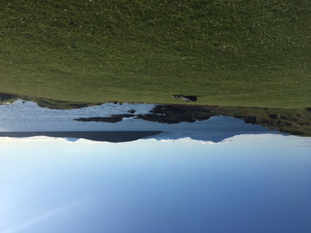
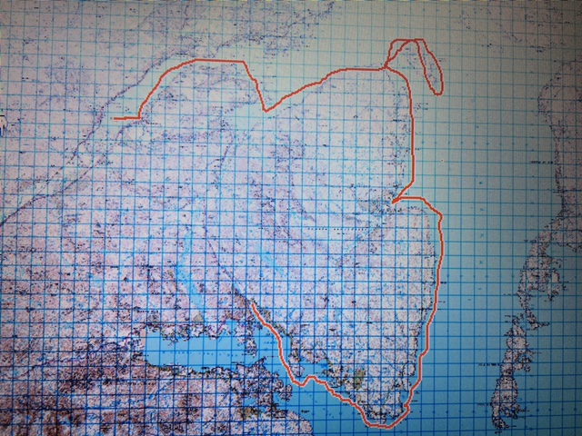
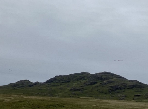
Sunday 24th March -Loch Morar Brinacory Circle The Club’s first scheduled paddle of 2024 took place on a chilly but calm Sunday towards the end of March. Twelve paddlers set off from Bun an Loin Bay (aka Viv’s Bay!) on Loch Morar and followed the north shore of the loch eastwards for about seven kilometres to Brinacory. From the water it is amazing to see how the path to Tarbet has been built up …the work of many men (and perhaps women!) over many years with very few tools and still a popular right of way today. Lunch was taken at Brinacory on the shore under the remains of the Schoolhouse. After eating, we paddled round Brinacory Island and headed across the loch to the little tree covered Eilean Allmha (the nearest meaning I found for Allmha was “alien, exotic, Foreign, Stranger”). Perhaps the little island holds a secret or two! Paddling west along the south shore of the loch we were able to clearly see the parallel furrows of the lazy beds. These were formed when potatoes were cultivated by laying them on the surface and covering them with kelp and with soil from a trench on either side of the bed. They were called “lazy beds” by contemporary writers because they were seen as a lazy method of farming. However, it seems to me that gathering kelp from the shore and transporting it to the hillside around the loch was anything but lazy! Distance travelled: 17.8km. |
|||||
|
|
|
|
||
Paddlers: Joan, Elizabeth, Bill S. & Jill, Peter K. Tasmin & Julie, Iain, Ruth, Mike, Kirsty and Lucy (who reduced the average age of the group by quite a few years!) |
|||||
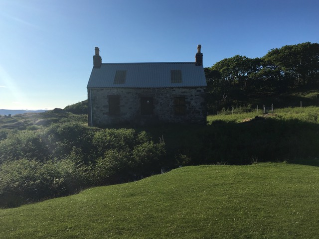
Saturday 20th April 2024 - Ardnish
|
|||||
|
|
|
|
||
Paddlers: Joan, Sheila, Ruth, Iain, Bill Sk, Adrian and Ania |
|||||
|
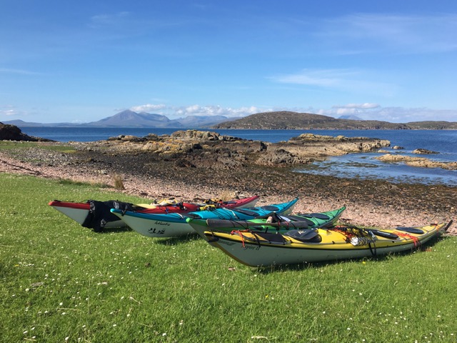
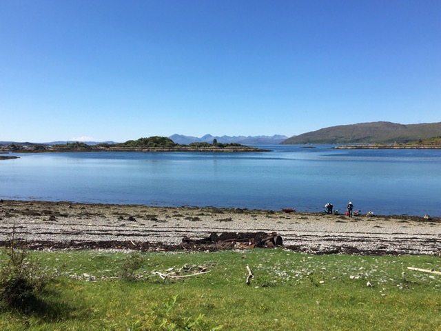
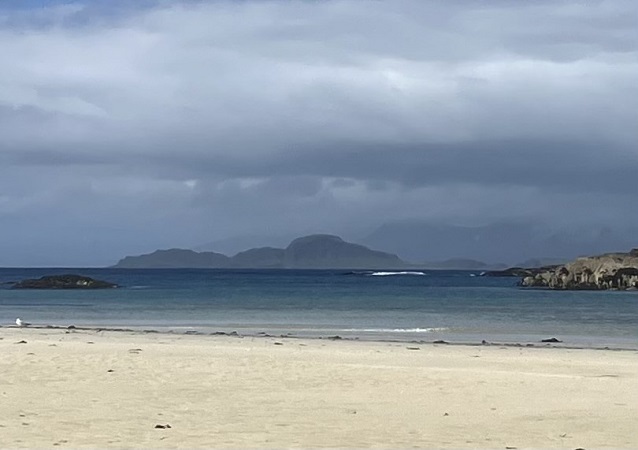
Summer Cruise 2024 - part one Saturday 18th to Tuesday 21st May Day 1 Shieldaig to Cuaig (21km) Six paddlers gathered at Shieldaig on a dull and breezy Saturday for the start of the first part of the Clubs Summer Cruise from Shieldaig to Loch Carron. As it was around 1pm, the group made a quick lunch stop at Camas Ruadh before setting off into a stiff wind across the mouth of Upper Loch Torridon and along the north shore of Loch Torridon before crossing to the south shore from Araid. The aim was to camp for the night at Fearnmore just south of Rubha na Fearn. However no suitable campsite was found and as the wind had dropped and the sea had turned to flat calm it was decided to round the point and camp at Cuaig. Just before rounding the point they were lucky enough to get a close up view of a couple of hunting otters. Tired after a long day the group soon had their tents pitched, dinner eaten and settled down for a well-earned sleep! Day 2 Cuaig to Uags (28km) Having packed up wet tents (there was mizzle in the night!) the group set off south from Cuaig pushed along by a gentle north wind. They stopped to have a look at the row of ruined cottages at Lonbain (from the gaelic An lon Ban white damp meadow). These had been tarted up for the filming of the 1983 production Ill fares the Land about the last days of habitation on St Kilda. One of the cottages is in the process of being fully restored including a rethatch. After a break to admire the huge beach at Sand they stopped at Applecross for ice cream before setting off towards Uags (from Uamhag meaning Hollow). On this stretch the northerly wind had picked up which made for tricky paddling, but the group was soon paddling into Uags bay where there is great camping and an MBA (Mountain Bothy Association) bothy which they could use to cook and escape the weather and/or the midge! Tents were soon pitched and dinner was eaten alfresco with the sun setting behind the Cuillins to the west while plans were laid for a paddle to the Crowlin islands the following day. Day 3 The Crowlin Islands (16km) The Crowlins which lie 2km west of Uags are made up of three islands Eilean Beag (Small Island), Eilean Meadhonach (Middle Island) and Eilean Mor (Big Island). A narrow channel of sea runs between Middle and Big Islands which is only navigable around high tide. The paddlers stopped at the south entry to the channel and walked to where they could see the water coming from the north end before having a snack and returning to the water. Paddling up the west coast of Eilean Meadhonach they admired the twisted red rock layers in the cliffs and pondered on the geology. After lunch the group paddled into the north end of the channel to see how far they could get. The tide was coming in fast and they managed to carefully navigate the kayaks all the way through. Returning to Uags dead wood was gathered from the oak woods behind the bothy and after another midge free dinner eaten outside the group retired to the bothy, lit the fire and enjoyed the craic! Day 4 Uags to Loch Carron (23km) Day four dawned calm and sunny and the paddlers were up and about early to break camp, say farewell to Uags and set off on the last leg of their journey. The plan was to lunch at the Kishorn Islands before passing through the narrows at the entrance to Loch carron at slack tide. Views soon opened up of the Skye Bridge and Plockton on their right and a sea eagle was spotted in the oak woods west of the deserted settlememt at Airigh Drishaig. As they set off across to the Kishorn Islands a huge oil platform hove into view at the mouth of Loch Kishorn. This turned out to be Diamond Drillings Ocean GreatWhite rig whose drilling equipment collapsed during a storm in early February. After a leisurely lunch on the shore behind the islands the group set off towards the entrance to Loch Carron. Here the landscape became more populated with small clutches of whitewashed homes at Ardaneaskin, Leacanashie, Stromemore and Strome Ferry (no ferry!). The ruins of Strome Castle could be seen perched strategically on a rock overlooking the narrows guarding the entrance to Loch Carron which reaches deep into the interior. The castle was built in the early 1400s by Alexander Macdonald, Lord of the Isles. After the battle of Morar (who knew??) in 1602 ownership of the castle was disputed between the Clan Mackenzie and the Clan MacDonell and was eventually demolished and blown up. Five kilometres into the loch the group landed at their takeout in the village of Loch Carron. After running a shuttle to pick up the cars left at Shieldaig, four of the group set off for Broadford in Skye for Part 2 of the Summer Cruise. Did they enjoy the same amazing weather and paddling conditions? Wait and see! |
|||||
|
|
|
|
|
|
Paddlers: Mike, Kirsty, Iain, Petra, Peter S and Joan |
|||||
Tuesday 11th June 2024 - Arisaig
|
|||||
| Paddlers: Ruth, Jeremy, John C and Peter K. |
|||||
Tuesday 11th June 2024 - Arisaig
|
|||||
| Paddlers: Ruth, Joan, Bill& Elvire |
|||||
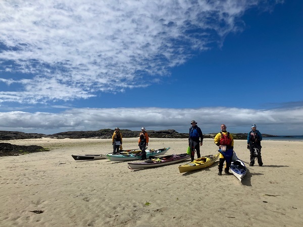
Saturday 23rd - Sunday 24th June 2024 - A "circumnavigation" of the Ardnamurchan peninsular
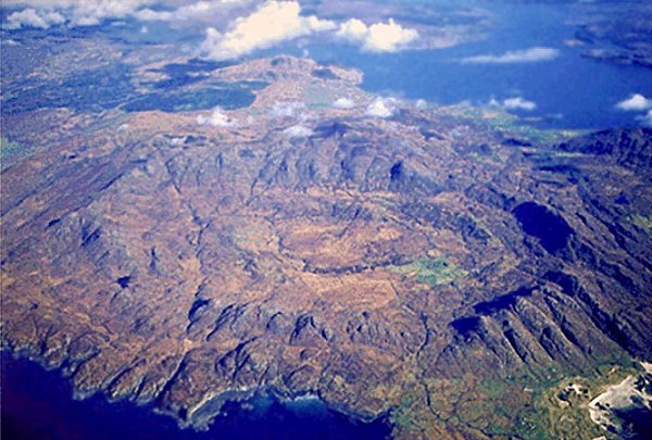
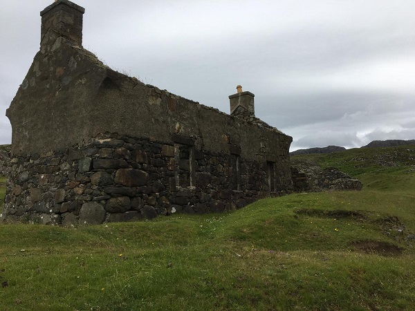
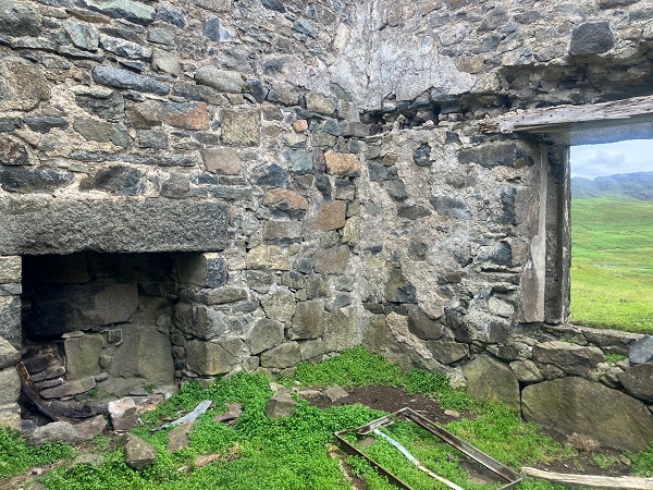
DAY 1 Three days in June to kayak from Salen to Ardtoe. Long days, good weather . what could possibly go wrong? Lets guess the weather. A week (and more) of forecast watching kept us guessing, planning and re-planning until, a day before start date things fell into a sort of place, a plan was finally hatched and .. it worked! Ardnamurchan or bust. Friday and Saturdays force 4/5 wind and rain forecasts made the prospect of paddling in either direction unattractive and unadvisable along challenging sections of coast. A last minute opportunity to camp at Ardnamurchan campsite presented a possibility for two good days at the far end of the peninsular. On Saturday four tents were pitched by 12.30 and 4 of the group enjoyed a walk to the historic village site at Glendrian, in the inner ring of the caldera (apparently technically a lopolith rather than a caldera) of the 5 mile diameter volcanic crater, which is thought to have been inhabited from the 1300s until this century. Photo credited to The Real Wild West. There were many golden-ringed dragonfly, one of which became rather attached to Joan, possibly attracted by her tasty-looking purple socks. On leaving the settlement we were treated to a fly-by of 9 Red Arrows, en route to Morar. Continuing towards the Glendrian caves the terrain became difficult, a deer fence blocked the way, the weather deteriorated and time ran out, so a retreat was beat to join the Sanna swimmer group back at the campsite, where a congenial evening was enjoyed in the comfort of a campervan. | |||||
|
|
|
|
|
|
|
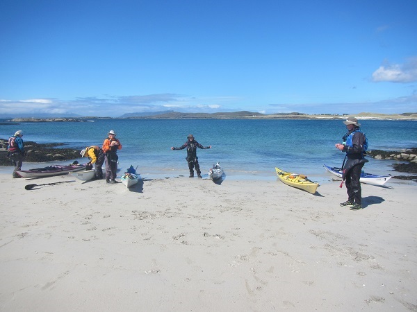
DAY 2 Expecting to wake to sunshine, it was disappointing to discover drizzle and grey skies but, by the planned shuttle time of 09:15 things were looking brighter. While the shuttle to Portuairk was effected, the remaining team stumbled down the stony shore with boats and kit ready for a 10:30 departure to maximise the journey round the Point. Getting away at 10:40 a 6km paddle into a comfortable force 3 got us to the wonderful little beach and hinterland at Eilean nan Seacdh Seisrichean (island of the seven sixes?). Although the time allowance was 30 minutes, a sunny hour of eating, chatting, admiring the vegetation and watching three birds, one hovering impressively on the spot above the cliffs (possibly a red kite) and 2 Peregrine falcons squabbling noisily up high, elapsed before re-embarking for the 4kms to the lighthouse, with whatever conditions that might bring (forecast following sea force 3/4 with 1.3m swell). A glance over the back suggested it would be more of the same, but experience proved to be a bit more challenging, with swell, clapotis, a following sea and a generally bumpy ride that required a good amount of focus and loose hips. Leaving the sheltered first lunch spot we took on the challenge of a line of incoming lively waves over rocks that proved to be fun rather than deadly. The lighthouse hove into view with much jubilation. Whilst most refrained from photography for fear of losing one thing or another, Iain, riding on Cloud Nine and clearly unphased by the rock and roll, impressively managed quite a few. Somewhere along the way a fantastically agile and very large fish (salmon?) was seen leaping vertically out of the water and returning with gravity three times. The Point passed and no crisis required immediate landing, so we continued on to the headland before Portuairk and convened to plan the onward route. Speeds of 11kms were achieved on this stretch, where we had the benefit of south westerly wind and the north easterly tidal stream pushing us along, with surfy waves to ride. It was originally thought we might continue round to Rubha an Dun Bhain or beyond and maybe check out the caves and Dun, but strengthening winds from the SW discouraged this, so it was agreed to paddle across to the far Sanna beach, where the tide was by now low but incoming, for a celebratory cake-fest. By this time Sanna was living up to its Caribbean reputation (but much, much better) with bright blue skies and sparkling blue seas. Views across to the cliffs of Muck were striking. Dragging the boats up the beach we encountered Roddy McDowell (Kayak Bute) who noted a Tiderace boat and various connections were made. As the boats began to drift about on the incoming tide a move was reluctantly made to continue. An outward trajectory being proposed, we headed out into more lively seas and wind and set our sights on Portuairk (which we now knew how to pronounce) where the vehicles were parked up the hill. The tide being still fairly well out (day before Springs), the haul up the beach was rather protracted. A later arrival would have facilitated a more easterly approach up a watercourse. Azure seas and skies of an indescribably bright blue made this all a pleasure. It was just a shame that we werent continuing the journey. Farewells and shuttles were made and everyone went their way with memories of a foreshortened but brilliant trip. Distance paddled: 16.4km. Distance swum: ? | |||||
|
|
|
|
|
|
Paddlers: Joan, Ruth, Elizabeth, Iain, Chris and Sheila |
|||||
|
|||||
|
|
|
|
|
|
|
|||||
|
|||||
|
|
|
|
|
|
|
|||||
|
|||||
|
|
|
|
|
|
|
|
|
|
|
|
| Paddlers: | |||||
|
|||||
|
|||||
 |
|
|
|
|
|
|
|
|
|
|
|
| Paddlers: | |||||
|
|
|
|
|
|
| Paddlers: |
|||||
|
|||||